Find out more about career opportunities at DeTect

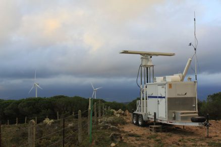
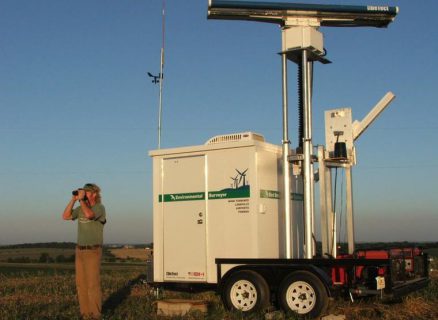
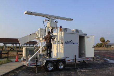
The MERLIN™ Avian Radar System is the most capable, proven and widely used bird and bat radar system available for conducting bird and bat surveys, research, mortality risk analysis, habitat and migratory studies, and for long-term and operational monitoring and mitigation of risks.
The MERLIN avian radar system provides the most proven, cost-effective, scientifically sound, and conclusive method for the collection of high-quality, statistically superior data on bird and bat movements at project sites, including wind farms, solar farms, airports, landfills and mines.
The MERLIN bird and bat tracking radar system uses technology originally developed by DeTect for the US Air Force and NASA for military aviation and space shuttle flight safety applications.
MERLIN avian bird control systems are the most advanced and proven avian radar technology available with over 1,200 systems delivered worldwide.
MERLIN avian bird control technology is supported by DeTect’s professional staff of experienced avian biologists and radar ornithologists that provides clients with the most experienced team of experts in remote sensing of birds and bats in the world – with specific expertise in design, construction and operation of wildlife/ bird detection radar systems for aviation safety and environmental management.
MERLIN uses state-of-the-art avian and bat radar systems with computer techniques developed specifically for detecting and tracking the unique behavioural characteristics of birds and bats to collect data continuously and automatically under a variety of conditions generating highly accurate, detailed datasets for analysis and for use in project decision-making, planning, permitting and risk management.
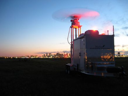
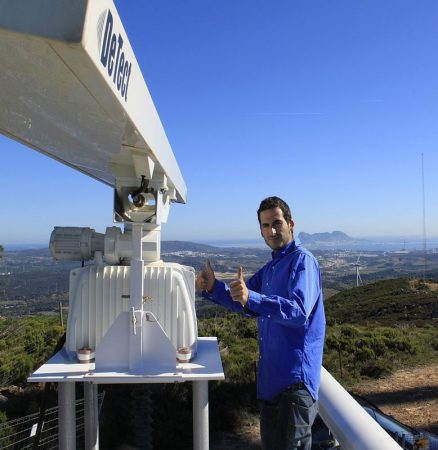
MERLIN radar detection is highly automated with a proven record of high operability and low maintenance in adverse environments. The bird and bat radar system can operate 24-7 unattended and is fully remote accessible and controllable through local networks and the Internet with a range of connectivity options that include WLAN, WWAN, and satellite.
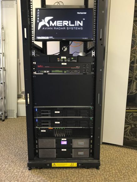
MERLIN avian and bat radar systems are delivered with a full range of standard data analysis routines as well as an optional SQL server data system. All data are also archived to disk an advanced SQL data system providing a permanent record for each project and for further post-processing and modelling with Geographical Information Systems (GIS), Google Earth and other analytical programs.
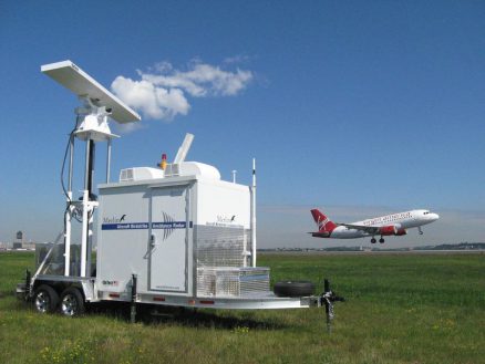
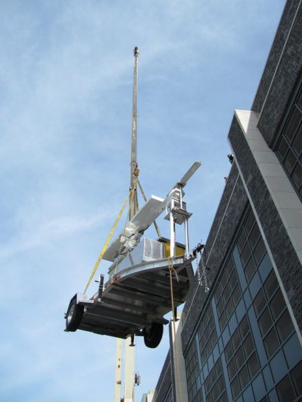
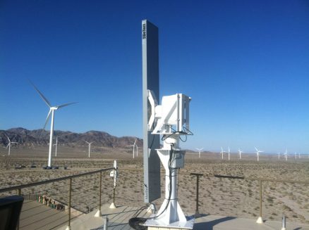
Avian and bat radar systems are fully self-contained with on-board control cabins, remote auto-start primary or back-up power systems, and include all hardware and software for bird and bat tracking, clutter suppression, interference rejection and data recording. Custom configurations, including fixed and offshore installations, can also be provided that integrate additional sensors such as thermal cameras, bat detection systems, insect detectors, vertical profilers and acoustic monitors.
DeTect provides complete avian bird control system installation and user training support.
Each system includes full parts and labour warranty and MERLIN radar software upgrades. Bird and bat tracking radar systems are available for short-term rental, long-term lease or for sale, both with and without DeTect operators.
Risk assessment radar surveys for wind energy projects offer significant benefits over conventional visual avian survey techniques. The MERLIN bird and bat risk assessment radar survey system is the most powerful and proven tool available for monitoring and real-time risk assessment at wind energy projects with bird and bat mortality risk mitigation radar systems in both terrestrial and offshore environments throughout the US and Europe.
MERLIN radars offer dual vertical and horizontal scanning, providing exceptionally accurate data on bird and bat passage rates and altitudes across proposed or existing wind farm sites and provides detailed bird and bat target databases for the rotor swept altitudes that can be used to provide quantitative determination of mortality risk to birds and bats at the wind farm.
The system also develops detailed data on bird and bat movements for the area surrounding the wind farm out to 2-4 NM and up to 10,000 feet in altitude. MERLIN ’s Data Analyzer program includes standard and custom database queries providing both tabular and graphical outputs quantifying the numbers of birds and bats passing through the rotor swept area allowing precise calculation and determination of bird and bat mortality risk.
Radar surveys for wind energy projects offer significant benefits over conventional visual avian survey techniques. The MERLIN system is the most powerful and proven tool available for assessment, monitoring and real-time risk mitigation at wind energy projects – in both terrestrial and offshore environments throughout the US and Europe.
MERLIN’s dual vertical and horizontal scanning radars provide exceptionally accurate data on bird & bat passage rates and altitudes across proposed or existing wind farm sites and provides detailed bird and bat target databases for the rotor swept altitudes that can be used to provide quantitative determination of mortality risk to birds and bats at the wind farm.
The system also develops detailed data on bird and bat movements for the area surrounding the wind farm out to 2-4 nm and up to 10,000 feet in altitude. MERLIN ’s Data Analyzer program includes standard and custom database queries providing both tabular and graphical outputs quantifying the numbers of birds and bats passing through the rotor swept area allowing precise calculation and determination of bird and bat mortality risk.
With MERLIN, users are getting more than an avian radar system – DeTect provides comprehensive application support with each system that includes risk assessment radar survey/ application design, system set-up, data collection support and project-specific user training.
Each bird and bat tracking radar system is also supported by DeTect’s team of avian biologists who have extensive backgrounds and experience in radar ornithology, avian biology, study design, bird control and risk mitigation on projects worldwide.
For bird and bat risk assessment survey radar applications, DeTect provides full data analysis support that includes custom algorithm development, data processing, reporting and risk analysis supporting client biologists and/or clients consultants.
MERLIN bird and bat tracking radar systems are for purchase, long-term lease or short-term rental, with or without DeTect operators and are backed by a comprehensive parts and labor warranty.
Please complete the enquiry form and a member of the DeTect team will contact you shortly.